
UAVs and ATAK – providing a full picture of the battlefield
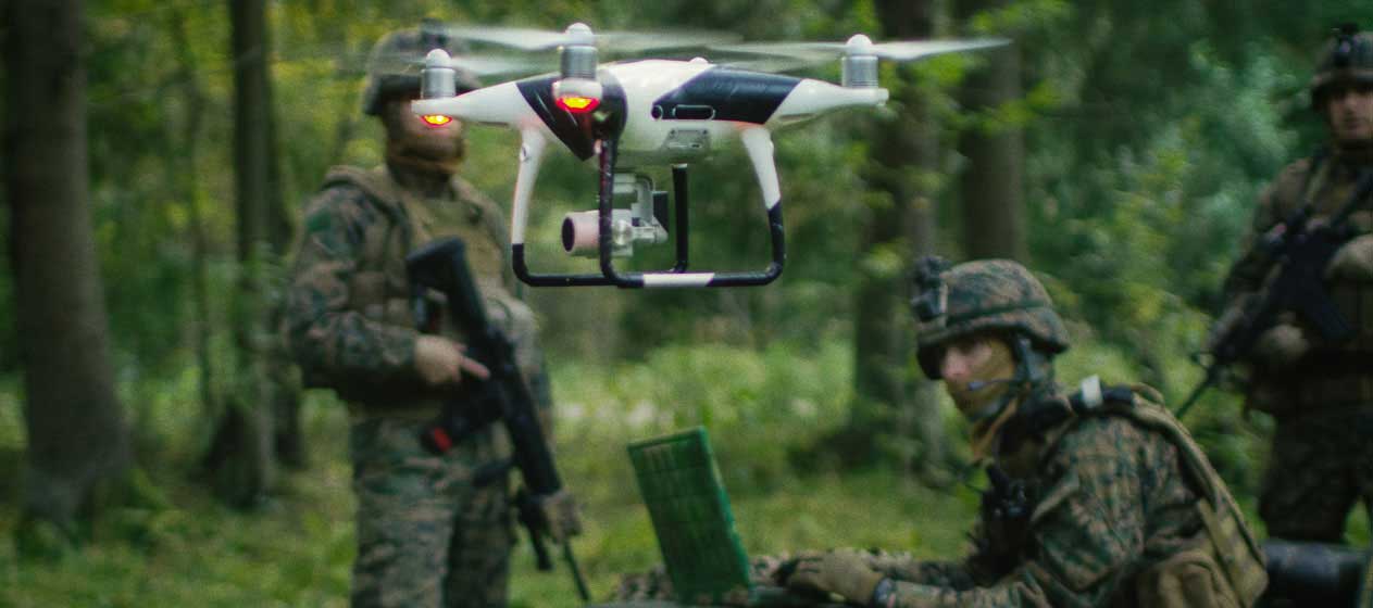
The use of unmanned aerial vehicles (UAVs) – or drones as they’re more commonly known – for intelligence, surveillance, and reconnaissance (ISR) functions is incredibly important for today’s military. UAV intelligence and data – whether that be still images or real-time, high definition video – serves a key function in providing situational awareness to those in theater and senior leaders back home.
This reliance on drone data isn’t going away. In fact, if anything, it’s increasing. Some industry pundits anticipate that the number of military UAVs – and the data they generate – will likely double by 2025.
But can drones really deliver all of the situational awareness that the military and the warfighter need in theater? I would argue that they can’t by themselves, and here’s why.
Looking through a drinking straw, through the fog of war
Battlefields are chaotic. Although technology may have evolved and changed in the three years since I returned, many of the UAVs that were in use while I was deployed flew very high above the battlefield. These UAVs utilized stabilized cameras that were pointed down from high altitudes. The result, in my experience, was an extremely myopic viewpoint that was exceptional for providing a clear image of a small part of the puzzle, but was insufficient for getting insight into the entire, chaotic battlefield.
For true situational awareness, military leaders need to see the bigger picture. Senior leaders are not on the front lines. Their awareness of what’s happening on a battlefield relies on the images and intelligence that are being generated by these UAVs, and they’re not seeing everything. They’re effectively looking through a drinking straw from tens of thousands of feet above the battlefield and only seeing a fraction of the picture.
As a result, when they’re focused on the enemy, they’re often not aware of the locations of their own forces. When they’re looking at their own forces, they’re not aware of enemy movements or locations. They need to see all parties simultaneously and their positions as they relate to each other. Not just a single, tunnel-vision view of one or the other from 20,000 feet above the battlefield.
During my two deployments to Afghanistan with the U.S. Army, we ran into multiple instances where this myopic view of the battlefield created problems. In my role providing support to troops on the ground, I faced situations where things went awry and not according to plan. We didn’t have real-time, observable battlefield intelligence or map overlays of where our friendly forces were in the battlefield, which made it incredibly difficult to provide support to them.
In those situations, trying to relay positions and explain physical location via voice radio was slow and confusing, and only managed to bog down the process of providing support to those soldiers in need. This meant that landing evacuation helicopters, laying down ordinance, and other support operations were delivered more slowly than they should have been –or could have been.
But there is another way.
ATAK and mobile mesh networking provide a bigger picture
I’ve only had a few experiences with ATAK and most of those have been limited to demonstrations at trade shows and conferences – such as the recent AUSA Conference in Washington, D.C. However, I really like what I’ve seen from the solution, and what it can deliver for deployed warfighters.
ATAK — when coupled with a mobile mesh networking solution — enables a much less myopic view of a battlefield for soldiers and military leaders regardless of whether there are existing, trusted terrestrial networks for connectivity or not.
When terrestrial networks are untrusted, non-existent or denied — as is often the case in theater — mobile mesh networking nodes and ATAK can work to share every unit’s individual location and overlay that location on a map. This can make it much easier to see exactly where friendly forces are located, see where they are in comparison to enemy troop movements, and see where support should be dispatched should it be needed.
With ATAK and mobile mesh networking solutions, each soldier’s location is displayed on a map. Should a helicopter need to be landed near injured soldiers, or ordinance laid down to support troops, those things can be done much more quickly and confidently than the traditional methods of having troops describe or share their locations via voice radio. The end result is faster support and services for soldiers that need them and better survivability for soldiers in the field.
That being said, ATAK won’t ever replace drones. There is a reason why the number of drones and the data being generated by drones is expected to double — they’re essential for military ISR functions and requirements. However, ATAK-equipped mobile devices and mobile mesh networking solutions are low-cost, small-format solutions that can be easily rolled out to soldiers and used in conjunction with drones and drone data for increased situational awareness in theater. And that is something that could only benefit troops and military leaders.
When soldiers’ lives are on the line, we shouldn’t be making important decisions with only part of the puzzle. We should have the whole picture. Combining ISR data from UAVs and map overlays from ATAK could deliver improved situational awareness and ensure better, more informed decision making for the military.

No Comment