

How the Dingell Act is making progress possible in wildland firefighting

Progress isn’t always observable. With 2020’s disastrous wildfire season, we saw the record-breaking loss of land and the loss of far too many lives. Knowing that wildland firefighting improvements were made in the face of such tragedy could be welcome. Confronting disaster is what wildland firefighters do. And seeking better days is what they work toward – reduced loss of acreage and property, lower casualty rates, and ideally, no loss of lives.
In December, the Institute for Defense and Government Advancement (IDGA) hosted a virtual conference to explore wildfire management best practices. The event included three days of forums, panel discussions, and presentations from government agencies, fire service leaders, as well as technology providers. A focus of several sessions was the impact and possible paths forward for incorporating the Dingell Act into wildland fire response.
The Conservation, Management, and Recreation Act, or the Dingell Act, which was signed into law in 2019, paved the way for better management of wildfires through resource tracking and technological advances. The goal of this legislation is to better equip and prepare firefighters, minimize their exposure to risk, and reduce overall costs – both human and financial.
The Dingell Act requires that emergency response organizations:
- Use technology to track fire resources
- Provide situational awareness through mapping
- Display resources on an active and accessible map
- Provide an accurate picture of the post-fire landscape to prevent flooding, erosion, etc.
- Enable information gained in past fires to predict the likelihood of future wildfires
The Dingell Act is intended to take the lessons learned from past wildfire seasons and begin to lay the groundwork for better fire management in the future. Requirements of this legislation also include conducting training and running two pilot projects to discover the best possible solutions in resource management. Any potential solution would need to incorporate a mix of technologies like GPS, communications devices, off-grid connectivity devices such as mobile mesh networks, and enable cross-agency coordination with minimally invasive training.
Everett Hinkley, the Remote Sensing Tools Program Manager with the U.S. Forest Service explained the Dingell Act, “…named after Senator John Dingell…there was a lot of direction to the Department of Interior and the Forest Service, or USDA to do a significant amount of conservation management, land enhancements, recreation enhancements. But there was also a section of it set aside specifically to enhance technologies for firefighting. One of the most popular ones is known as resource tracking.”
This entails putting devices on firefighters, using unmanned aircraft, camera systems, and mapping software to provide situational awareness in wildfire response management. Hinkley continued, “Situational awareness is not only for our airmen and other pilots but also for the firefighters on the ground.”
To improve situational awareness and resource tracking, the Forest Service worked collaboratively with NASA, the FAA, and the Department of Homeland Security, and other agencies to discover the best available technologies.
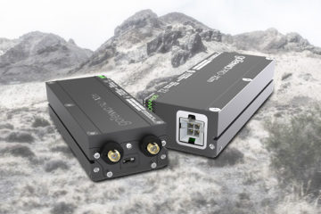
One app that has shown great promise in wildland firefighting is the ATAK app. ATAK provides a real-time mapping solution that allows situational awareness for both firefighting resources and of the wildfire itself. Each resource, or firefighter, carries a device that places them on the shared map and is delivered via mobile devices. It also allows the map to be updated as conditions change.
As the unmanned aircraft captures the position of the fire, it can be transferred to each member and command posts. This saves valuable time in communications for those on the ground, and also allows the best decisions to be made about the location of personnel and equipment. In the past, the imagery of fires would be captured during the night and delivered to crews as they began their efforts each morning.
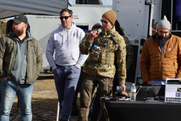
Brad Schmidt, the Wildland Fire Program Manager with the Center of Excellence for Advanced Technology Aerial Firefighting and the Colorado Division of Fire Protection and Control explained how ATAK enables a better day for wildland firefighters, as was discovered during the pilot program which ran during the Grizzly Creek Fire in Glenwood Canyon, Colorado this past August:
“So, rather than only getting a map once every 24 hours, we were able to push new mapping content as soon as it became available to the firefighters participating in this pilot project. So, in total, we deployed twenty-eight TAK devices across the incident. We received 154,000 location reports during our 13-day pilot project and on average devices reported their position out about every two minutes.”
Pilot projects like this have begun to put functional systems and devices into use. The projects have allowed agencies to begin to develop the right combination of gear along with training and implementation best practices – battery charging and device usage, which team members need a device, and allowed a look into reliability in harsh conditions.
While these were pilot projects, they provided actual value during the fire and valuable information post-fire. Schmidt explained, “…the night division supervisor was very happy using the app. We did have an initial attack fire that occurred during Grizzly Creek and resources were pulled from the Grizzly Creek incident to respond to this fire. And at least one person that we talked to was able to navigate to that initial attack fire just by looking for the cluster of dots for all the other resources that were there that allowed them to not have to key up a radio or ask for directions on how to get to the new fire.”
The Dingell Act, the pilot projects, and a host of technologies are all providing opportunities for learning from this season’s fires. These are yielding training opportunities, better wildland firefighting during the trials, and a step forward for the next round of wildland firefighting efforts. In this case, progress is not only visible in the present, but it’s also enabling future progress.


No Comment