ATAK and goTenna Pro X for the JTAC – improved situational awareness for faster close air support
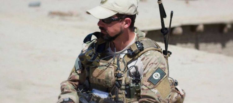
Having served in the United States Air Force as a Joint Terminal Attack Controller (JTAC), I understand the importance of situational awareness for conventional and special operations forces missions. During my twenty years of service, I contributed to countless missions in austere environments attached to U.S. and coalition ground forces, Army Special Forces teams, and Navy SEAL task forces as the subject matter expert and operator for all things air to ground.
As figurative “puppet masters” in the coordination and control of airpower, JTACs are among the elite few in the U.S. military authorized to independently coordinate and control airstrikes. For nearly every airstrike directed by the U.S. and its coalitions — be it with fighter aircraft, bombers, attack helicopters, or drones — a JTAC is behind it. They are the warriors on the ground responsible for providing terminal control of combat airpower onto enemy targets, integrating airpower into the ground force commander’s scheme of maneuver, and incorporating the intelligence that ISR aircraft generate into the ground fight. No matter the mission — from close air support to high value targeting to combat search and rescue to landing and drop zone control — JTACs are the key link between air and ground.
Maintaining Situational Awareness with Mission Packets
As a vital part of the ground force, JTACs are also responsible for creating the mission packets that all team members will utilize for situational awareness during the operation. Before ATAK entered the scene, this packet consisted of printed-out maps and reference information including gridded reference graphics (GRGs) — satellite imagery overlaid with numbered buildings, landmarks, and references. Once the mission kicked off and the JTAC was out on the “objective” controlling aircraft overhead to support the ground force, he had to align what he was seeing in the real world and his own GPS coordinates to the graphics and maps in the mission packet, tracking friendly positions and generating targets based on that correlation.
When you think about this process in practice, you realize that it had a number of challenges. First, situations on the ground can change, and those changes could even occur between when the imagery was generated and when the operation took place. This meant that what we were seeing on the ground may have no longer been in-line with our mission packets. Worse, relaying physical locations and keeping situational awareness on friendly force locations accurately — what we call “battle tracking,” a key component of our job — could be difficult. With static GRGs, tracking physical locations from other units that were often spread throughout large areas required referencing multiple image sheets.
This paper-heavy process delayed operations — and delays are a big problem in air-to-ground missions, which are all about timing. The window to drop ordinance from the air onto an enemy is often a small one that shrinks with time as the adversary moves. On the battlefield, time is literally about life and death.
Swapping GRGs with ATAK
When we incorporated Android devices and the ATAK application into our toolkit, it gave us a much-needed timing advantage. It eliminated the use of static GRGs where we’d have to flip through laminated sheets of overlaid imagery to do our battle tracking and targeting. Instead, mission packets were loaded into the application and displayed on the screen for the operator. Even better, the operator could also view their own location in ATAK, providing quicker positional referencing and targeting.
But it wasn’t the end-all solution. With a standalone ATAK setup, the JTAC still had to manually plot other friendly locations into the app based on updates from teammates via voice radio — if any. Even today, traditional communications systems still prevent various ATAK operators from sharing a single, real-time picture of the battlefield across individuals in a single team or a wider joint coalition task force.
A mesh networking radio device called goTenna Pro X solves that problem. And if I’d had this device back when I was a JTAC, it would have been a game changer.
ATAK and goTenna Pro X for the JTAC
goTenna Pro X enables individual ATAK users to “speak” to one another through a secure, intelligent mesh communications system that doesn’t rely on cellular or other terrestrial networks, or interfere with existing line of sight voice communications. This device also presents has a vastly different form factor compared to existing mesh networking radios — it’s small and light enough to augment any kit without increasing the equipment burden.
Now, with ATAK and goTenna Pro X, an entire team of operators can each see one another’s locations in real time and send secure texts and mission data. Each operator not only has a moving map, but real-time position location updates on all friendly units carrying the same devices. Team members can correlate one another’s locations as fast as it takes to look at their ATAK screen and scroll the map. And they can communicate via encrypted chat and send vital mission information such as targeting, landing zone locations, and references with a few touches on a screen.
ATAK paired with goTenna Pro X enables an unparalleled level of team situational awareness — better than anything we’ve seen before. For the JTAC, it cuts vital time in battle tracking and targeting which means enhanced mission effectiveness and lives saved.
In modern warfare, the JTAC is the warfighter charged with some of the greatest responsibility on the battlefield. The job is difficult, but essential. goTenna Pro X with ATAK makes the JTAC more efficient and helps him operate both faster and safer. And that can be the difference between mission success… and mission failure.




No Comment